May 2015
Breakthrough at Wynyard Walk
Since July 2013 the work is going on at „Wynyard Walk“ in Sydney/ Australia
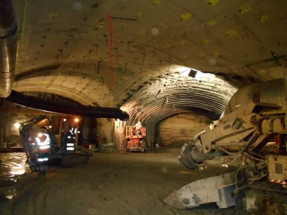
The building project: a pedestrian tunnel which connects the district Barangaroo with the Wynyard Station – with the aim to shorten the walk to about 6 min. The 180m long tunnel with a width of 9m and a height of 3.5m was excavated with conventional construction methods using a road header. The accurate navigation of the machine has been assured by the VMT Navigation System SLS-Roadheader. After an advance period of about 10 months the breakthrough was announced – finalization of the entire project is scheduled for 2016.
From the beginning the challenge in this project has been and still is the exact monitoring of the directly above town center: stability and functionality of all buildings and infrastructure must be constantly and reliably monitored, since only very small reduction tolerances apply. In addition, all major parameters of the construction process must be recorded and made available in real time for various evaluations. VMT has risen to this challenge with its deformation monitoring system in combination with the information system IRIS and mastered so far. Essential components and functions of the deformation monitoring, which is supervised by a three-member survey team, are:
- Automatic 3D surveillance of buildings, roads and structure with motorized total stations
- Manual geodesic supervision of the reference network, various buildings and structures
- Two automatic hydrostatic level systems with a total of 17 sensors
- Automatic and manual tilt control to buildings and structural components
- Well logging with portable inclinometer along the pit
The recorded measurements and the derived time series are transferred to the web-based information system IRIS. All users depending relevant data of the central database can be accessed browser-based. The information system thus provides a convenient platform for consolidation and presentation of monitoring results from various disciplines. In Wynyard Walk project, these are geodesy and measuring technology. Therefore a customized tool is placed at the disposal of the responsible site managers which provides the necessary information for timely decision process in a convenient and reliable manner.


